
Latest news & articles
Feature updates, technical explanations, and case studies from real inspection work.
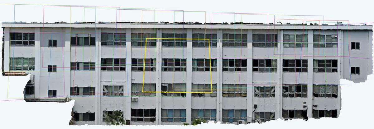
How much overlap do drone photos need? Front overlap and sidelap explained with diagrams — shooting for good orthophotos and 3D models
How much should drone photos overlap when you want to build an orthophoto or a 3D model from them? This visual guide covers what front overlap and sidelap mean, why overlap is needed at all, the recommended values from Pix4D, Agisoft Metashape and Japan's national survey manual (and the conditions behind them), how to calculate shot spacing, what changes when you shoot a building facade, why thermal overlap depends on what you align with, and why shooting too much also hurts.
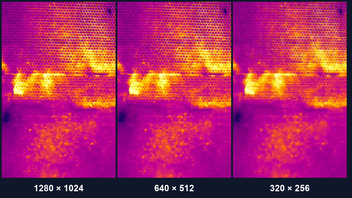
How to choose a drone thermal camera for inspection: resolution, field of view, temperature measurement and data format
A visual guide to choosing a drone thermal camera. Compare 640×512 and 1280×1024 by working out how many centimeters one pixel covers on the target, check whether the camera is radiometric, understand R-JPEG and other data formats, pair it with a visible camera, and handle high-resolution modes. Includes official specs for the DJI Matrice 30T, Mavic 3T, Matrice 4T, Zenmuse H20T and H30T, and Skydio X10.
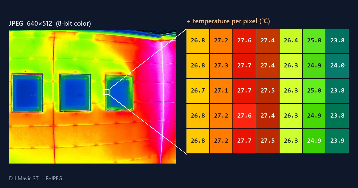
What is R-JPEG? Inside a drone thermal image — why the JPEG you see is not the temperature data
Open a DJI drone thermal image (R-JPEG) in an ordinary image viewer and all you get is a colored picture. This illustrated guide explains the three things packed into one file — the picture, the raw thermal data, and the calculation inputs — why you cannot read temperature from colors, why the JPEG and the thermal data can have different resolutions, how it differs from FLIR radiometric JPEGs, where the DJI Thermal SDK and DJI Thermal Analysis Tool fit, and what to know about High Res mode.
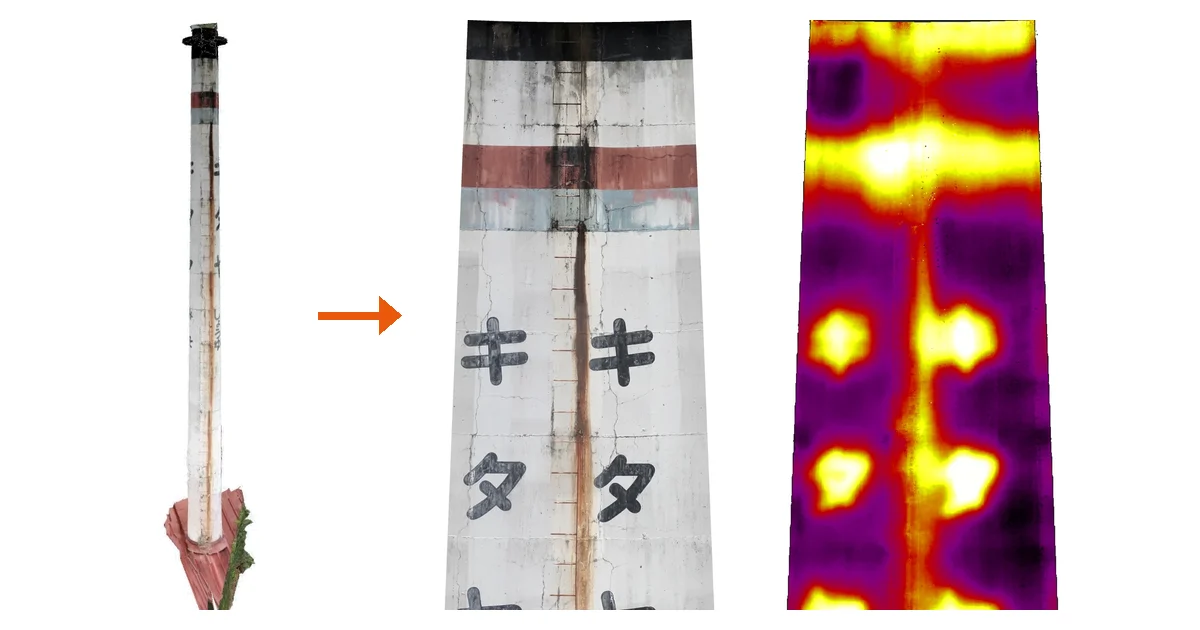
Chimney and tank inspection on one unwrapped image: opening up the photos you took all the way around
Inspecting chimneys and tanks means you can never see the back, the photos split into dozens of shots, and it is hard to say where anything is in a report. This article explains the unwrapped development drawing (a rectangle for a cylinder, a fan for a tapered chimney), how such an image is built from photos, and what an infrared unwrap can and cannot tell you, using a real chimney as the example.
Solar panel infrared inspection: what causes hot spots and how to find them
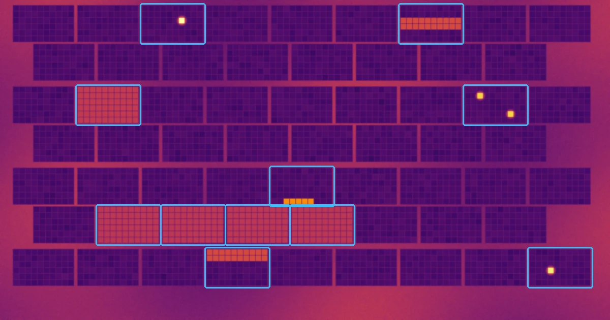
Why do hot spots form on PV modules? This illustrated guide lines up the typical thermal patterns (cracked cells, soiling and shade, bypass diodes, whole strings down) by the shape they leave in a thermal image, then covers the capture conditions (600 W/m² irradiance, system operating, avoiding reflections), the drone inspection workflow, why an orthomosaic of the whole array helps, and what goes into the report, with IEC TS 62446-3 and industry guidelines as sources.
Emissivity and reflected temperature on thermal cameras: why your readings don't match, and how to fix them
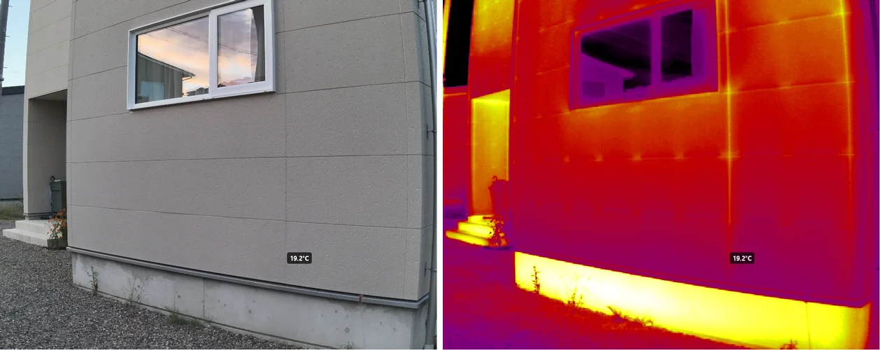
Thermal camera readings that disagree with a contact thermometer, windows and metal that look impossibly cold — most of the time it is not a faulty camera but emissivity and reflected temperature settings. This guide explains what a thermal camera actually measures, lists typical emissivity values by material, shows how to measure reflected temperature with aluminum foil, and covers distance and humidity, why metal and glass are hard, and how to correct the settings after capture.
Why thermal cameras can find delaminated facade tiles, and why the pattern flips at night
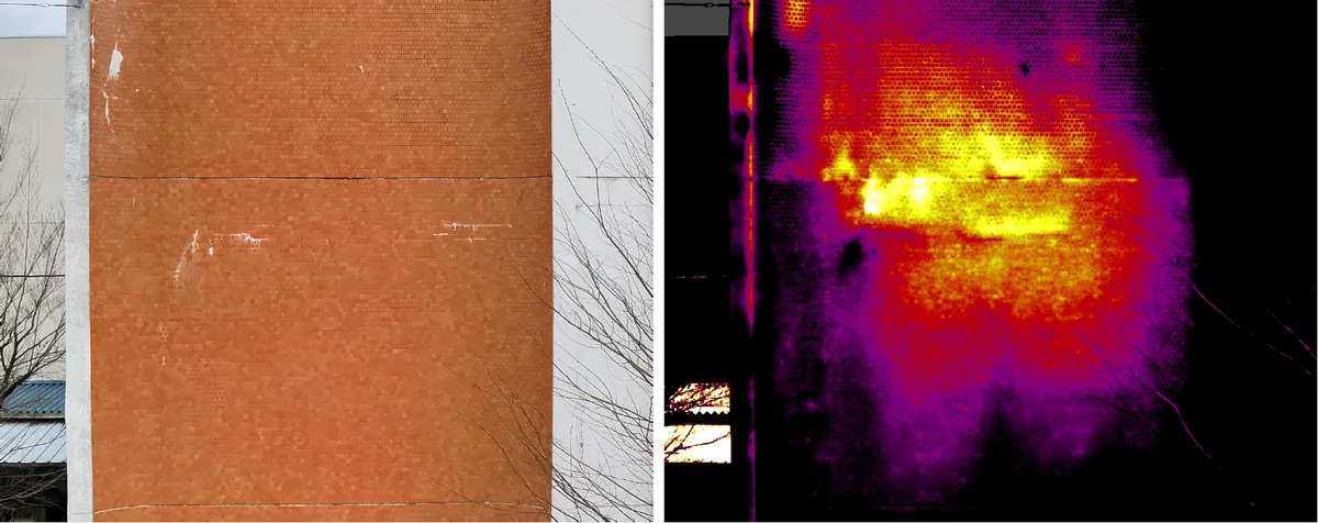
How infrared surveys detect debonded (delaminated) facade tiles, explained with diagrams and real thermal images. Why a delaminated area looks warmer by day and cooler after sunset, the conditions that hide the contrast (overcast skies, north faces, shade, wind), the usual causes of false positives (reflections, color, materials, equipment heat) and how to rule them out, and how infrared relates to hammer tapping.
What is an orthophoto? How it differs from a photo, explained with diagrams — from aerial maps to building facades
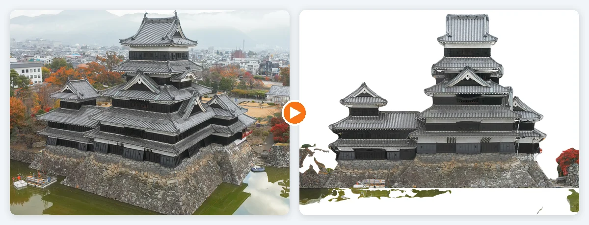
A visual introduction to orthophotos (orthoimages) and how they differ from ordinary photos. Covers relief displacement (why tall buildings lean outward), true orthophotos, the four steps from photos to an orthophoto, map orthos versus facade orthos, and the conditions where orthophotos fail — with real examples from Matsumoto Castle and a retaining wall.
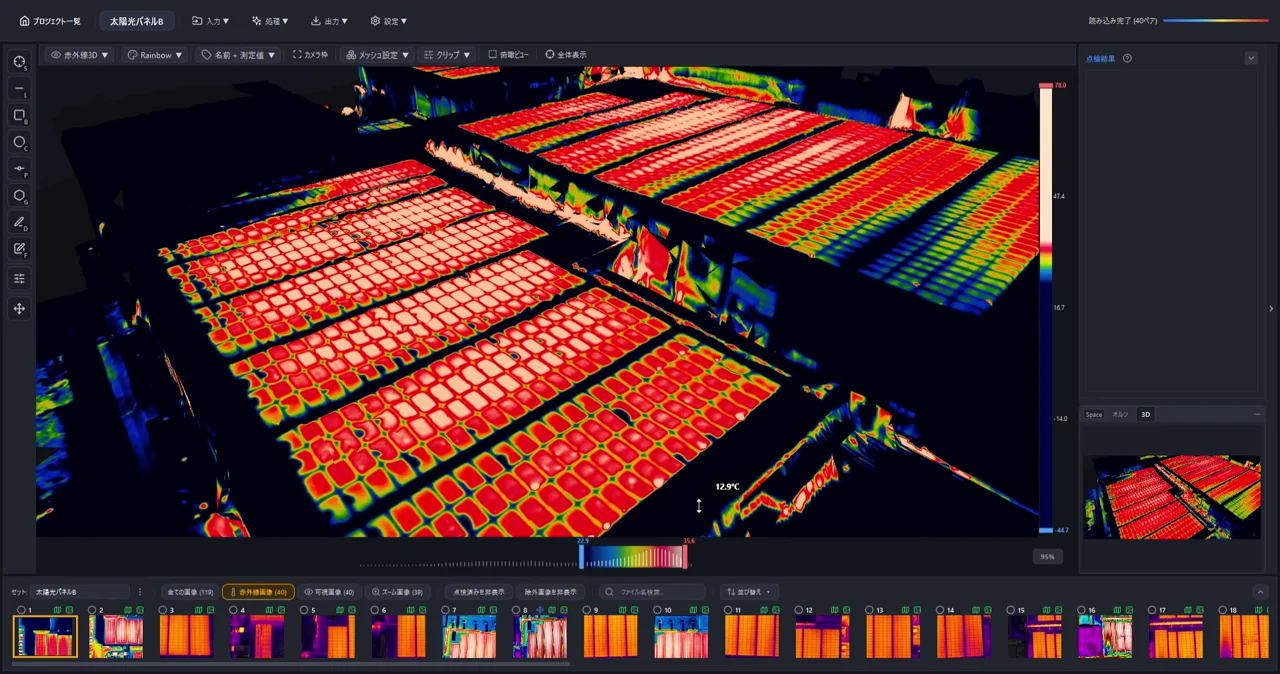
Generate 3D Models from Drone Photos — Build Temperature-Colored (Thermal) 3D Models with CRITIR
Learn how to automatically generate 3D models of buildings and structures from drone or ground-camera photos. With CRITIR, you get a visible-light 3D model plus a temperature-colored thermal 3D model, all linked to measurements and report output — streamlining inspection documentation for complex facades, equipment, and solar panels.

Analyze Skydio X10 thermal images directly in CRITIR, no conversion needed
CRITIR now supports the Skydio X10 (VT300-Z payload). Read its FLIR Boson+ radiometric R-JPEG thermal images directly — no conversion — and run temperature analysis, facade orthoimage generation, measurement projection, and reporting in one app. Built for facade, solar, and infrastructure inspection workflows.
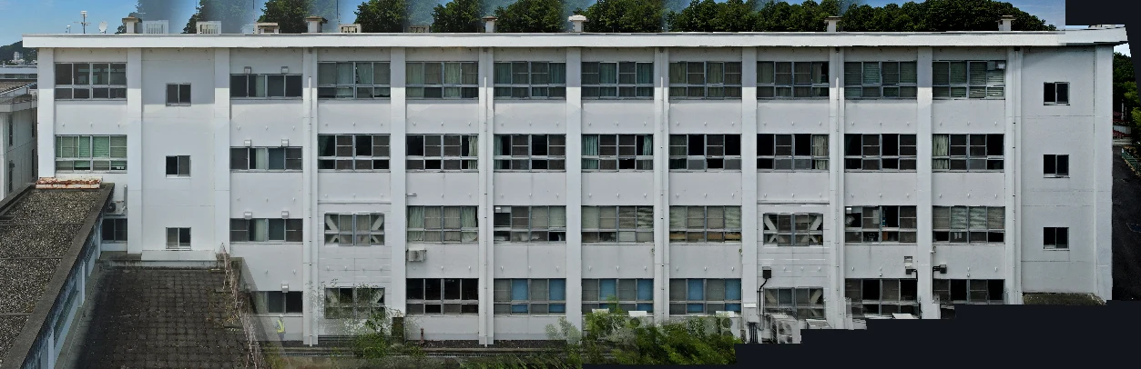
Generate facade and wall orthoimages automatically with CRITIR
A clear walkthrough of how facade and wall orthoimages are built from drone or ground-camera shots, and how CRITIR simplifies the process. Where RealityCapture (RealityScan) and Metashape require significant manual work for vertical surfaces, CRITIR automates the pipeline — including thermal orthoimages — to streamline facade inspections and defect surveys.
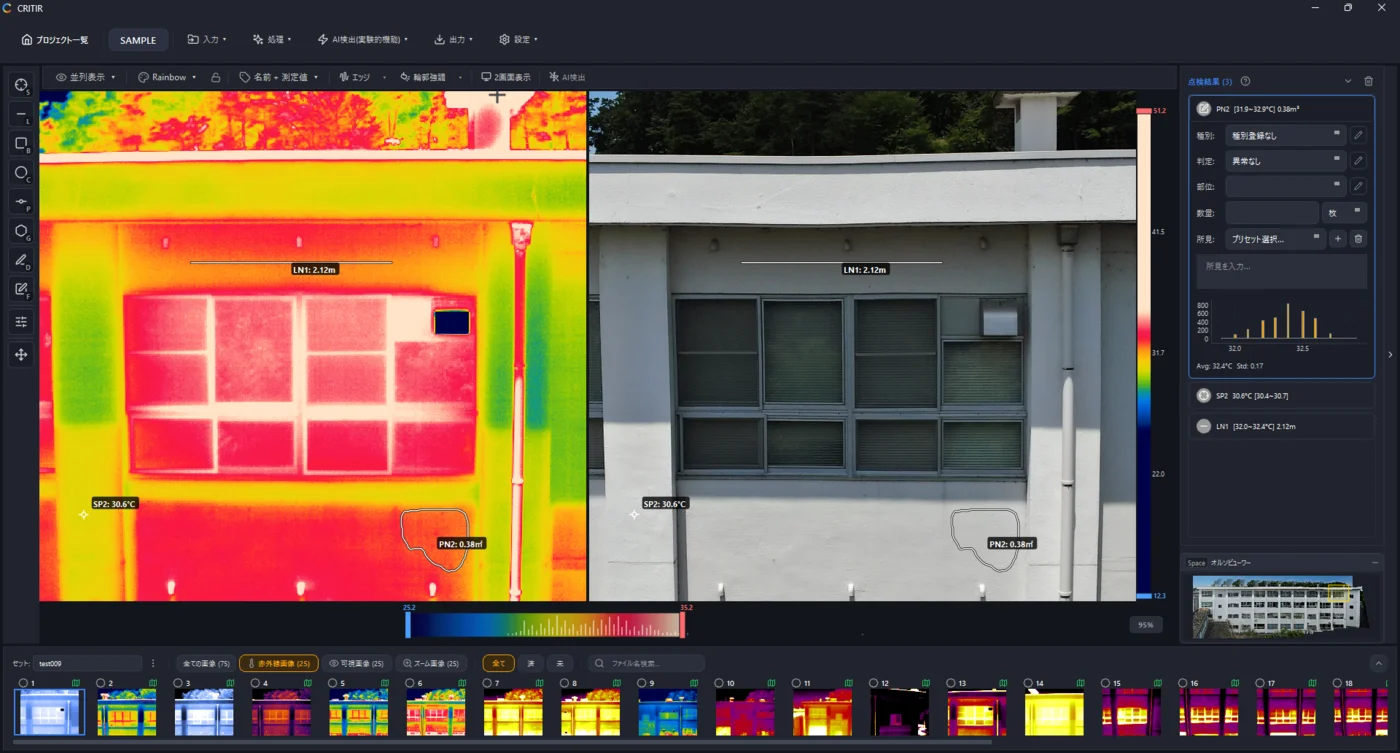
Analyze DJI thermal images directly in CRITIR, no conversion needed
Skip the conversion step for DJI R-JPEGs. CRITIR analyzes DJI thermal images directly, generates facade orthoimages, and produces reports — all in one app. Cut the cost and time spent on converter tools and conversion services.